Shenzhen Pengjin Technology Agency
M
Icasense rededge and Parrot Sequoia cameras are welcome.
Spectral imaging technology is a new imaging technology that combines spectral analysis technology with optical imaging technology. Therefore, spectral imaging technology can not only realize the qualitative and quantitative analysis function of spectral analysis technology, but also obtain more accurate optical imaging technology. Intuitive target object distribution map provides more accurate information for analysis, detection, monitoring, measurement and other applications. Spectral imaging can be divided into three categories: multispectral imaging, hyperspectral imaging, and hyperspectral imaging, depending on the spectral resolution of the sensor.
The multi-spectral imaging technology is mainly based on the principle that the absorption of light of different wavelengths by objects is different, and the application requirements of detection and discrimination are realized by changing the light intensity of the target object in a specific light wavelength in a range of infrared and near-infrared. There are certain differences between hyperspectral imaging and hyperspectral imaging techniques, each with its own characteristics. For example, hyperspectral imaging technology describes materials by measuring changes in light intensity over a continuous wavelength range, while multispectral imaging Techniques are determined by a change in light intensity over a specific range of wavelengths, and so on. With the continuous improvement of multi-spectral imaging technology, its application range is also expanding, especially in the fields of medicine, agriculture, military and security.
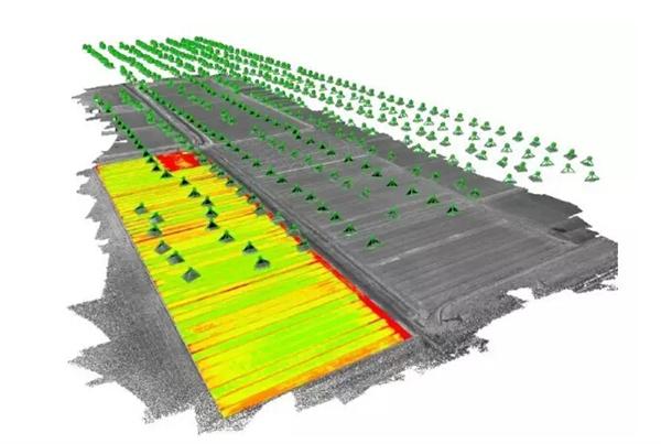
In the agricultural field, multi-spectral imaging technology can obtain the images of different features on different spectral segments by sensing energy from different narrow bands of visible light to thermal infrared, so as to identify the specific conditions of the ground objects, mainly used for crop disease diagnosis. , agricultural product quality testing, crop growth status monitoring and other aspects. In addition, in the face of major natural disasters, multi-spectral imaging technology can also play an important role in disaster assessment, provide accurate disaster assessment reports, and provide accurate information for decision-making departments to develop disaster relief and disaster reduction programs. 
M
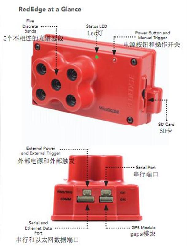
Icasense rededge 
Features
Collect five discrete spectral bands simultaneously.
Narrowband filters provide maximum image resolution for a single band.
High-speed acquisition speeds increase flight speed and flight altitude.
The spherical shutter design eliminates image distortion on a variety of platforms.
Store all geotagged images in one
SD
In the card.
No moving parts, sturdy and durable.
It can be operated stand-alone, and external triggers and data links from the aircraft can also be selected.
Instant web interface, can and arbitrarily
Wi-Fi
Device connection.
Optional pass
Ethernet
Or the serial port is connected to the aircraft for direct configuration, state change and camera control.
Product specifications
weight:
150g
Size: 12.1cmÑ…6.6cmÑ…4.6cm
powered by:
5.0VDC, 4W
Spectral band: blue, green, red, red, near infrared (narrow band)
Total number of pixels
: 120
Million per band
,
Total
600
Ten thousand
Land size:
200px
Located per pixel (per band)
120m
Height from the ground
Interface: serial port,
Ethernet, GPS
Field of view:
47.2
â—‹
HFOV
Usb Data Cable,Charging Data Cable,Usb Data Transfer Cable,Fastest Data Transfer Cable
Guangzhou YISON Electron Technology Co., Limited , https://www.yisonearphone.com